English
中国农业科学院
智慧农科
邮箱
官方微信
微信公众号
微信公众号
首页
单位概况
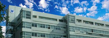
农业环境与可持续发展研究所是中国农业科学院直属研究所之一,办公地址设在北京市海淀区中关村南大街12号
单位简介
环发所章程
所长致辞
现任所领导
历任所领导
组织机构
信息化平台
碳领域科技创新
宣传视频
新闻中心
要闻动态
科研进展
学术交流
合作交流
党建文化
图片新闻
媒体报道
通知公告
人才队伍
杰出人才(按照拼音排序)
正高级(按照拼音排序)
副高级(按照拼音排序)
科研平台
国家级平台
部级平台
国家科技创新联盟
国家农业环境观测实验站
重大成果
国家级成果
省部级成果
标志性成果
团队建设
团队介绍
团队成员
团队动态
党建文化
党建工作
群团工作
政策法规
合作交流
国际合作
国内合作
研究生教育
学科专业
招生录取
导师队伍
研究生管理
期刊学会
中国农业气象
中国农学会农业气象分会(二级学会)
单位概况
单位简介
环发所章程
所长致辞
现任所领导
历任所领导
组织机构
信息化平台
碳领域科技创新
宣传视频
新闻中心
要闻动态
科研进展
学术交流
合作交流
党建文化
图片新闻
媒体报道
通知公告
人才队伍
杰出人才(按照拼音排序)
正高级(按照拼音排序)
副高级(按照拼音排序)
科研平台
国家级平台
部级平台
国家科技创新联盟
国家农业环境观测实验站
重大成果
国家级成果
省部级成果
标志性成果
团队建设
团队介绍
团队成员
团队动态
党建文化
党建工作
群团工作
政策法规
合作交流
国际合作
国内合作
研究生教育
学科专业
招生录取
导师队伍
研究生管理
期刊学会
中国农业气象
中国农学会农业气象分会(二级学会)
首页
邮箱
English
搜索
官方微信